TOWN & VILLAGE
TOWNSHIP OF WAWARSING
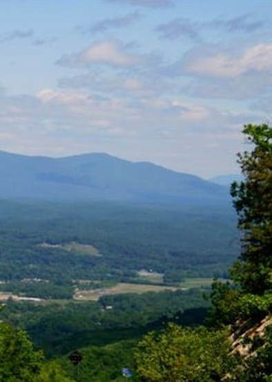
The Town of Wawarsing is in the western part of the county. The southern and eastern-most portions are on the Shawangunk Ridge. Most of the hilly town is in the Appalachian foot-hills, while the northern most part is in the Catskills. It has three State Forests (Shawangunk Ridge, VerNooykill, and Witches Hole), as well as most of Minnewaska State Park and Sam's Point Preserve, and portions of the Catskill Preserve and Sundown State Park. US Route 209 crosses the town, passing through many principal communities: Spring Glen, Laurenkill, Ellenville, Napanoch, the hamlet of Wawarsing, Soccanissing, and Kerhonkson. US Route 44 begins at a junction with 209 near the east town line. N.Y. Route 52 runs east-west near the southern border. All three roads are part of the Shawangunk Ridge National Scenic Byway.
The northern part of the town is the southern-most portion of the Catskill Mountains. The eastern border is the Shawangunk Ridge (pronounced Shaw-ong-ungk). Rondout Creek passes through the town, as do the Sandburgh, Laurenkill, Beerkill, Fantinekill and VerNooykill creeks.
Town of Wawarsing (including Ellenville) 12,889
Town of Wawarsing: 132.9 square miles
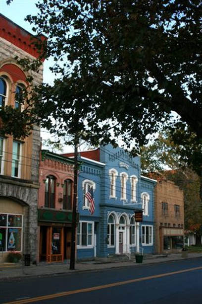
VILLAGE OF ELLENVILLE
As of the census of 2000, there were 4,130 people, 1,540 households, and 1,033 families residing in the village. The population density was 474.4/mi². There were 1,778 housing units at an average density of 204.2/mi². The racial makeup of the village was 69.06% White, 11.67% African American, 0.48% Native American, 1.57% Asian, 0.00% Pacific Islander, 12.32% from other races, and 4.89% from two or more races. 28.40% of the population were Hispanic or Latino of any race.
There were 1,540 households out of which 36.1% had children under the age of 18 living with them, 39.2% were married couples living together, 21.7% had a female householder with no husband present, and 32.9% were non-families. 26.2% of all households were made up of individuals and 12.1% had someone living alone who was 65 years of age or older. The average household size was 2.65 and the average family size was 3.16.
In the village, the population was spread out with 28.9% under the age of 18, 9.7% from 18 to 24, 27.5% from 25 to 44, 21.6% from 45 to 64, and 12.3% who were 65 years of age or older. The median age was 34 years. For every 100 females there were 88.8 males. For every 100 females age 18 and over, there were 82.1 males.
The median income for a household in the village was $27,474, and the median income for a family was $40,942. Males had a median income of $30,732 versus $21,250 for females. The per capita income for the village was $15,272. 23.4% of the population and 20.8% of families were below the poverty line. 31.4% of those under the age of 18 and 15.2% of those 65 and older were living below the poverty line.
LOCAL VILLAGE GOVERNMENT
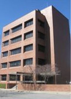
Offices of the Village of Ellenville are housed at the Ellenville Government Center, 2 Elting Court, which, at five-stories, is the tallest building in the village and town.
The government of Ellenville is headed by a Board of Trustees, composed of an elected mayor and four trustees. As of 2007, all terms were increased from two years to four years, and elections were moved from March to November. Regular meetings of the Board are held on the second and fourth Mondays of each month. Village Court convenes each Tuesday evening in the same meeting room.
Daily administration is supervised by an appointed village manager, an appointed village clerk, an appointed village treasurer, and department heads for each of the following departments: police, street, water, sewer, building & code enforcement. Village offices are open from 8:30 AM to 4:00 PM, Monday through Friday; the police department is open at all times.